![]()
Western States Paso Finos
Trail Reports & Directions
Out West we are
fortunate to have many beautiful places to trail ride and camp with our horses.
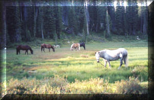
On this page you can ride along on adventures in some wonderful places with a great deal of variety. Learn more about how to get there and what to bring along, as well as what to watch out for. Whether you would like to escape the hustle and bustle and get away for several days, or pack a lunch and spend one day in the great outdoors, this is the place to find what you're looking for.
If you would like to share some of your favorite trail rides, please send them to our webmaster by using the Contact WSPF button at the bottom of the page. Your contributions will help us make our trail directory better and better.
Saddle up and head out to see what's around the next bend and over the hill!
Click on the Ride Names Below for Directions, Info and Photos.

New Trail Reports and Photos for 2009!
GrandJean Horse
Camping
-
South Fork Payette River area of Central Idaho
(opens a new page with a Word document and photos)
2008 Trail Reports and Photos:
Cape Horn Horse
Camping
-
Cape Horn area of Central Idaho
2007 Trail Reports and Photos:
Red Rock Country Ride - Sedona, Arizona
The "Left Behind" Trail Ride in Northern Idaho
White Pine Basin Trail Ride near Salt Lake City, Utah
Beaver Creek Horse Camp in Stanley Basin, Idaho
|
Trail Ride Archives (click on name for full report) |
Introduction to the Report |
|
This is a trail ride that can be tailor-made for a perfect fit. Short or long, desert or evergreen forests. You're sure to find something for everyone! We rode the Weiser River’s abandoned railroad bed trail a few times last fall and this spring. The Friends of the Weiser River Trail (FWRT) have a website www.weiserrivertrail.org with some basic maps and information – but here is some more specific information for planning your trip. .... |
|
| Trail riding in
the Sawtooth National Forest in central Idaho has a great deal to offer.
A Sawtooth National Forest map ($7 at ranger stations) covers most of the area but the adjoining Boise and Challis National Forest maps would be helpful as well. Most trails are marked on these maps – but some are not, some are inaccurate and some portions don’t exist anymore. A call to the Stanley Ranger station (208)774-3000 would help with any trails you’re not sure about. The easiest thing to do is decide which trail you want to ride and while driving out the access road to the trailhead, pick one of the many campsites you'll see along the way. Your decision is limited by what you want to drive your vehicle on and how far off the access road you want to be. .... |
|
| Wilson Creek in the Owyhees - Near Boise, Idaho | The Owyhee
Mountains in southwestern Idaho have beautiful high desert vistas and
rugged river canyons. If you are in the right places there is a
chance to see herds of wild horses on the Bureau of Land Management
range. Wilson Creek in the Owyhee Foothills is reached by the Owyhee Uplands National Back Country Scenic Byway (State Highway 78). It is also close to the Deer Flat National Wildlife Refuge and the nationally-renowned Snake River Birds of Prey Area. A great place for a 1-day ride! .... |
![]()
![]()
![]()
![]()
![]()
![]()
![]()
![]()
![]()
![]()
![]()
![]()
![]()
Page Design by Syringa Ranch Paso Fino Horses